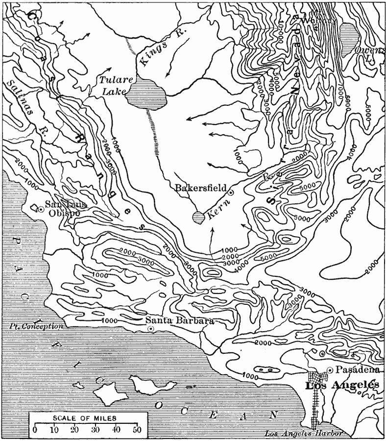
Description: A contour map of a part of central California showing the area of the southern Central Valley and Sierra Nevada Mountains, the Coastal Range from north of San Louis Obispo to Los Angeles, and the Tehachapi ridge. The map shows the interior watershed drainage into Tulare Lake.
Place Names: California, Los Angeles, �Pasaden
ISO Topic Categories: oceans,
location,
inlandWaters
Keywords: Contours of Central California, physical, �political, physical features, local jurisdictions, oceans,
location,
inlandWaters, Unknown, 1916
Source: Albert Perry Brigham & Charles T. McFarlane, Essentials of Geography (New York, NY: American Book Company, 1916) 31
Map Credit: Courtesy the private collection of Roy Winkelman |
|