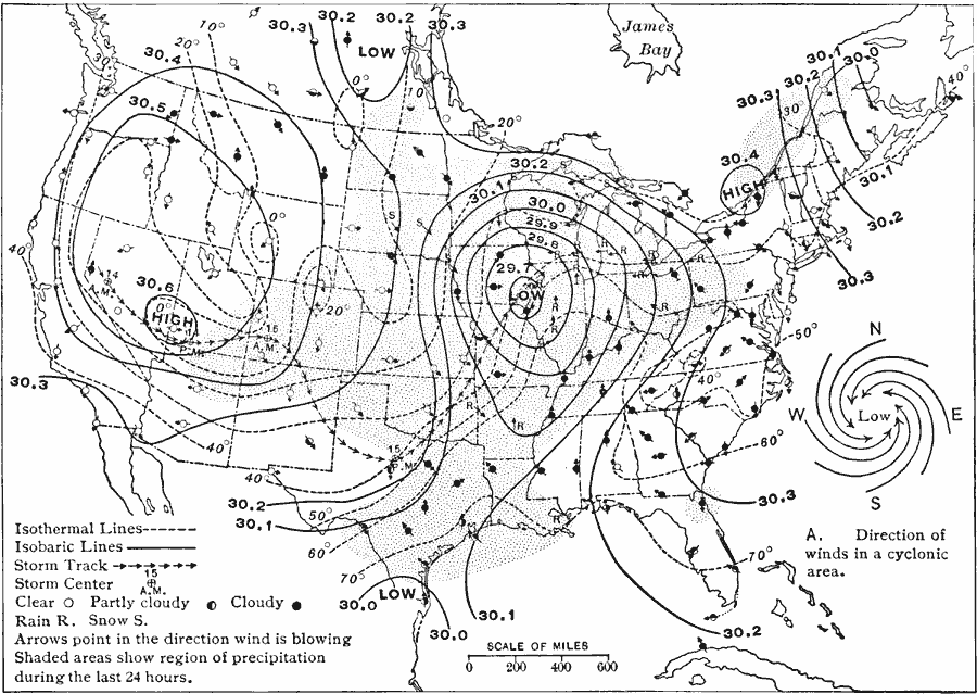
Description: A sample weather map for Tuesday, November 16, 1909 showing typical symbols found on winter weather maps at the time, including symbols for clear weather, partly cloudy, cloudy, rain, and snow, wind arrows showing prevailing wind direction, isobar lines, isotherm lines, and shading representing precipitation during the preceding 24 hours.
Place Names: Meteorology,
ISO Topic Categories: boundaries,
inlandWaters,
location,
oceans,
climatologyMeteorologyAtmosphere
Keywords: Weather of the United States, physical, �political, �meteorological, physical features, country borders,
major political subdivisions, winds,
temperature, boundaries,
inlandWaters,
location,
oceans,
climatologyMeteorologyAtmosphere, Unknown, Tuesday November 16, 1909
Source: Albert Perry Brigham & Charles T. McFarlane, Essentials of Geography (New York, NY: American Book Company, 1916) 45
Map Credit: Courtesy the private collection of Roy Winkelman |
|