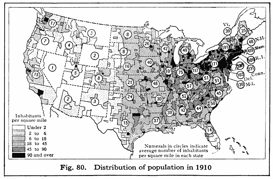
Description: A map of the United States showing the distribution of the population in 1910. The map is keyed to show areas of population with densities ranging from under 2 inhabitants per square mile to 90 and over inhabitants per square mile. The figures in circles indicate the average number of inhabitants per square mile in each state.
Place Names: Demographics, populatio
ISO Topic Categories: boundaries,
oceans,
location,
inlandWaters,
society
Keywords: Population Density, physical, �political, �statistical, kPopulation, physical features, country borders,
major political subdivisions, population, boundaries,
oceans,
location,
inlandWaters,
society, Unknown, 1910
Source: Albert Perry Brigham & Charles T. McFarlane, Essentials of Geography (New York, NY: American Book Company, 1916) 49
Map Credit: Courtesy the private collection of Roy Winkelman |
|