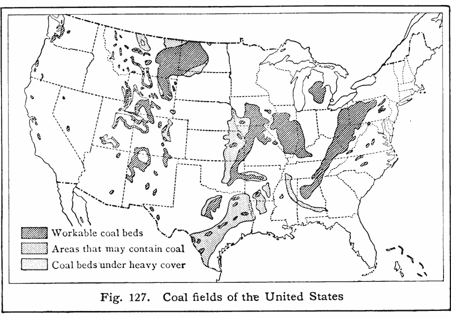
Description: A map from 1916 of the United States showing the known and undeveloped coal fields at the time. The map is keyed to show the workable coal beds, areas that may contain coal, and coal beds located under heavy cover or overburden.
Place Names: Minerals, coa
ISO Topic Categories: boundaries,
location,
oceans,
inlandWaters
Keywords: Coal Fields of the United States, political, �physical, kResources, geological, major political subdivisions,
country borders, industry, boundaries,
location,
oceans,
inlandWaters, Unknown, 1916
Source: Albert Perry Brigham & Charles T. McFarlane, Essentials of Geography (New York, NY: American Book Company, 1916) 82
Map Credit: Courtesy the private collection of Roy Winkelman |
|