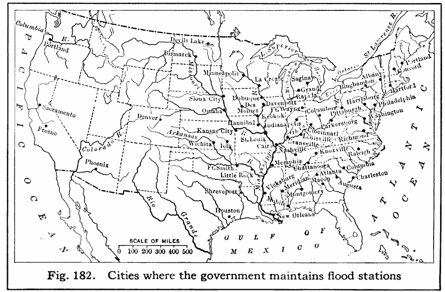
Description: A map from 1916 of the United States showing the cities where the government maintained flood stations at the time. "Reservoirs to hold back flood waters have been proposed, but their construction would be very expensive. The Weather Bureau keeps flood stations on the Ohio River, the Mississippi, and many other rivers, to warn people of the rising of the waters, so that they can guard against damage to shipping, wharves, buildings, and crops." — Brigham and McFarlane, 1916, p. 117.
Place Names: A Complete Map of the United States, Washington D.C., �New Orleans, �Portland, �Denver, �Houston, �Atlant
ISO Topic Categories: boundaries,
location,
oceans,
inlandWaters
Keywords: Flood Stations, physical, �political, kHydrologic, physical features, country borders,
major political subdivisions, boundaries,
location,
oceans,
inlandWaters, Unknown, 1916
Source: Albert Perry Brigham & Charles T. McFarlane, Essentials of Geography (New York, NY: American Book Company, 1916) 117
Map Credit: Courtesy the private collection of Roy Winkelman |
|