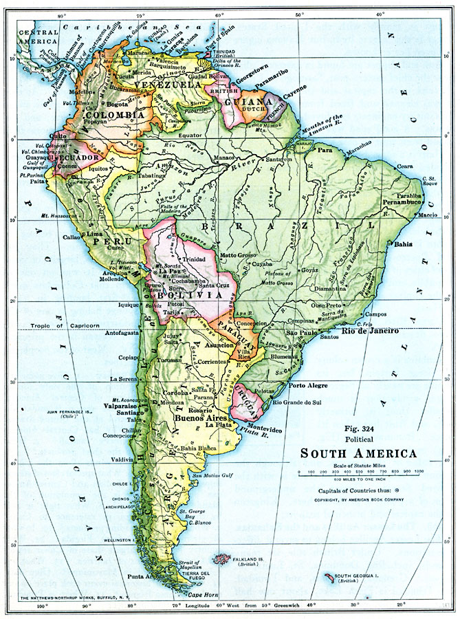
Description: A map of South America from 1916 showing the political boundaries of the time. The map shows capitals, major cities, ports, rivers, terrain, and coastal features.
Place Names: A Complete Map of South America, Argentina, �Bolivia, �Brazil, �Chile, �Columbia, �Ecuador, �Paraguay, �Peru, �Uraguay, �Venezuel
ISO Topic Categories: boundaries,
transportation,
inlandWaters,
location,
oceans
Keywords: Political Map of South America, physical, �political, physical features, country borders, boundaries,
transportation,
inlandWaters,
location,
oceans, Unknown, 1916
Source: Albert Perry Brigham & Charles T. McFarlane, Essentials of Geography (New York, NY: American Book Company, 1916) 218
Map Credit: Courtesy the private collection of Roy Winkelman |
|