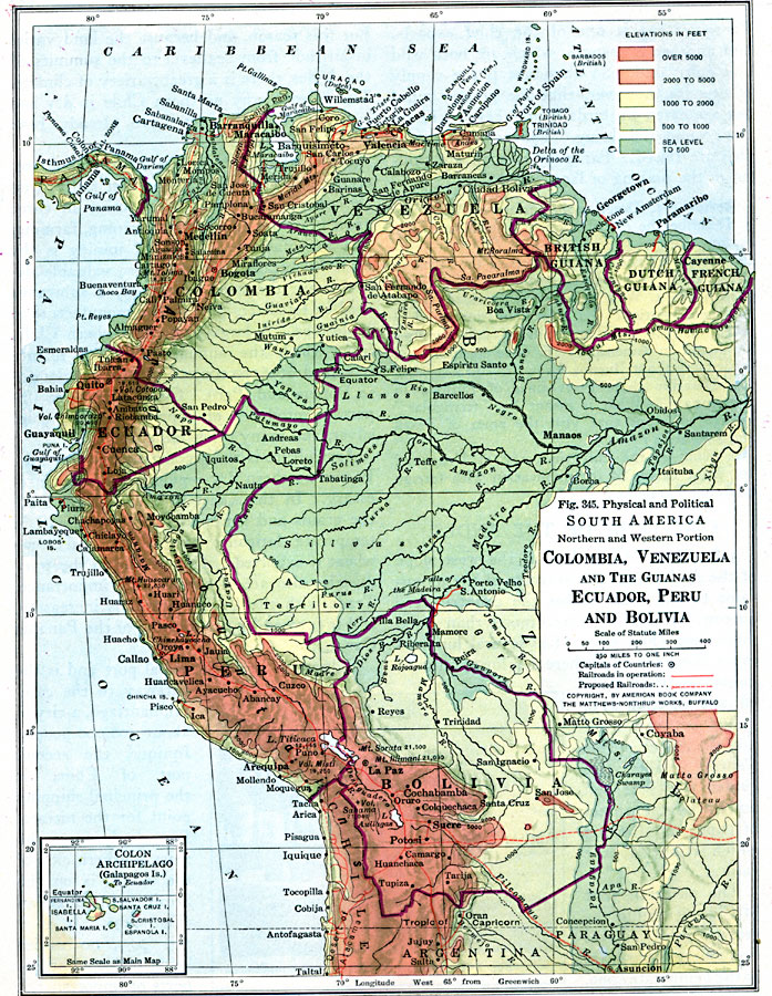
Description: A physical and political map of northwestern South America in 1916 showing the boundaries for Columbia, Venezuela, the Guianas, Ecuador, Peru, and Bolivia at the time. The map uses color–contouring to show elevations from sea level to above 5000 feet, and shows capitals and major cities, existing and proposed railroads, rivers, terrain, and coastal features of the region. An inset map details the Colon Archipelago (Galapagos Islands).
Place Names: A Regional Map of South America, Columbia, �Venezuela, �Ecuador, �Paraguay, �Bolivi
ISO Topic Categories: boundaries,
transportation,
location,
oceans,
inlandWaters,
planningCadastre
Keywords: Northwestern South America, physical, �political, �transportation, physical features, country borders, railroads, boundaries,
transportation,
location,
oceans,
inlandWaters,
planningCadastre, Unknown, 1916
Source: Albert Perry Brigham & Charles T. McFarlane, Essentials of Geography (New York, NY: American Book Company, 1916) 236
Map Credit: Courtesy the private collection of Roy Winkelman |
|