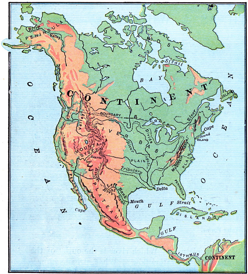
Description: A study map from 1899 using North America to illustrate various geographic terms commonly found on maps. The map shows examples of continent, river valley, peninsula, strait, bay, political boundary, lakes, island, ocean, cape, sound, river basin, river basin divide, mountain system, mountain range, river system, river source, right bank and left bank of rivers, tributary, river mouth, delta, plain, plateau, gulf, and isthmus.
Place Names: A Complete Map of North America, Bahamas, �Canada, �Cuba, �Mexico, �United State
ISO Topic Categories: oceans,
inlandWaters,
location,
boundaries
Keywords: North America, borders, �physical, �topographical, kMapSkills, physical features,
topographical, country borders, oceans,
inlandWaters,
location,
boundaries, Unknown, 1899
Source: Horace S. Tarbell, LL.D. , The Complete Geography (New York, NY: American Book Company, 1899) 6
Map Credit: Courtesy the private collection of Roy Winkelman |
|