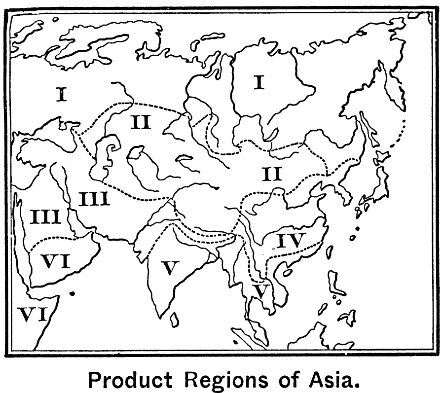
Description: A map of Asia from 1899 showing the primary agricultural production regions of Asia. This map is keyed to show the Northern Plain – region of forests (I), Central Asia – steppes and deserts (II), Mediterranean region – fruits, cereals, cotton, and indigo (III), Central and northern China – tea and mulberry trees (IV), Chief agricultural region – rice, cereals, cotton, and opium (V), and African region – dates and coffee (VI).
Place Names: A Complete Map of Asia, Asi
ISO Topic Categories: oceans,
inlandWaters,
location,
farming
Keywords: Agricultural Regions of Asia, physical, �statistical, kAgriculture, physical features, agriculture, oceans,
inlandWaters,
location,
farming, Unknown, 1899
Source: Horace S. Tarbell, LL.D. , The Complete Geography (New York, NY: American Book Company, 1899) 108
Map Credit: Courtesy the private collection of Roy Winkelman |
|