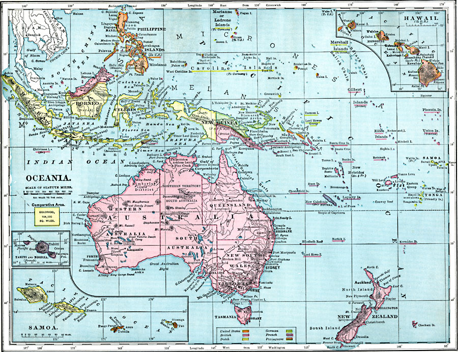
Description: A map from 1899 of Oceania and the Pacific between latitudes 20° N and 48° S, and longitudes 100° E and 170° W of Greenwich. The map shows cities and ports, railways, rivers, lakes, terrain, coral reefs, and coastal features of the region. This map is color–coded to show the foreign possessions of Britain, France, Germany, Netherlands, Portugal, and the United States at the time. Inset maps detail the Hawaiian, Samoan, and Tahitian islands. Longitude from Washington is given at the bottom of the map, and includes an outline map of Colorado at the same map scale to show the comparative area size relationship.
Place Names: Regional Pacific Ocean, Australia, �Borneo, �Celebes, �New Zealand, �Papua New Guine
ISO Topic Categories: borders, �topographical, �physical, kComparativeArea, kWorldPacific
Keywords: Oceania, borders, �topographical, �physical, kComparativeArea, physical features,
topographical,
geological, country borders, borders, �topographical, �physical, kComparativeArea, kWorldPacific, Unknown, 1899
Source: Horace S. Tarbell, LL.D. , The Complete Geography (New York, NY: American Book Company, 1899) 126
Map Credit: Courtesy the private collection of Roy Winkelman |
|