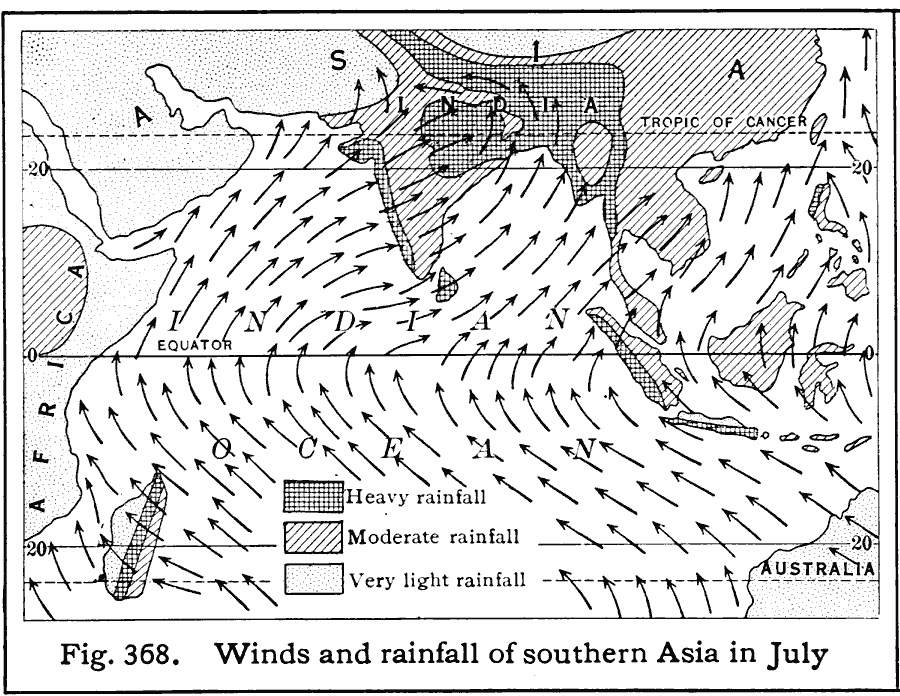
Description: A map of Southern Asia from 1916 showing the prevailing wind directions and currents in the region in July. This map illustrates the summer monsoon conditions, when moist winds blow from the Indian Ocean northward over the land, giving the region its wet season. This map shows areas of heavy, moderate, and light mean seasonal rainfall patterns.
Place Names: Regional Indian Ocean, Asia, �Afric
ISO Topic Categories: physical, �meteorological, kClimate, kWorldIndian
Keywords: Winds and Rainfall of Southern Asia in July, physical, �meteorological, kClimate, physical features, rainfall,
winds, physical, �meteorological, kClimate, kWorldIndian, Unknown, 1916
Source: Albert Perry Brigham & Charles T. McFarlane, Essentials of Geography (New York, NY: American Book Company, 1916) 258
Map Credit: Courtesy the private collection of Roy Winkelman |
|