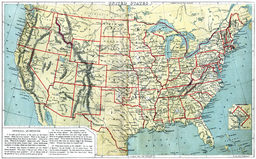
Description: A map from 1888 of the United States showing state boundaries and state capitals, major cities and towns, mountain systems, lakes, rivers, and coastal features. Longitude from Greenwich is shown at the top of the map, and from Washington at the bottom. An inset map details the District of Columbia. The map also includes map skills questions typical of classroom work at the time.
Place Names: A Complete Map of the United States, Seattle, �San Francisco, �Portland, �Newport, �Tampa, �Albany, �Tallahassee, �Baton Rouge, �Springfield, �Detroit, �Portland, �Phoenix, �Salt Lake City, �Helena, �Denver, �Des Moines, �Pierre, �Duluth, �Indianapolis, �Atlant
ISO Topic Categories: boundaries,
inlandWaters,
location,
oceans
Keywords: United States, physical, �political, physical features, country borders,
major political subdivisions, boundaries,
inlandWaters,
location,
oceans, Unknown, 1888
Source: , Cornell's Intermediate Geography (New York, NY: American Book Company, 1888) 22-23
Map Credit: Courtesy the private collection of Roy Winkelman |
|