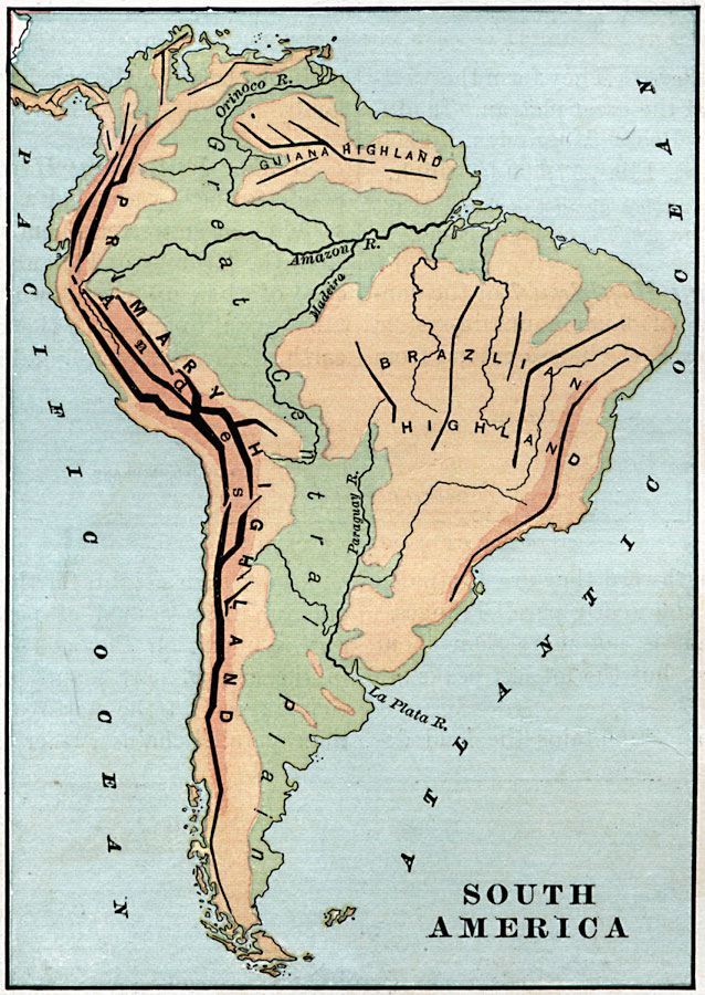
Description: An orographic map of South America from 1885 showing the primary mountain systems and general elevations. The map is color–coded to show highlands in buff tint, lowlands in green, and the major mountain chains with heavy black lines. The map shows the primary highlands and Andes along the west coast, the Guiana Highlands in the north east, the Brazilian Highlands, and the Great Central Plains extending from Venezuela to Patagonia. Major river systems are also shown.
Place Names: A Complete Map of South America, Guiana Highland, �Brazilian Highland, �Primary Highland, �Ande
ISO Topic Categories: elevation,
inlandWaters,
oceans
Keywords: South America, physical, physical features,
topographical, elevation,
inlandWaters,
oceans, Unknown, 1885
Source: M. F. Maury, Physical Geography (New York, New York: University Publishing Company, 1885) 32
Map Credit: Courtesy the private collection of Roy Winkelman |
|