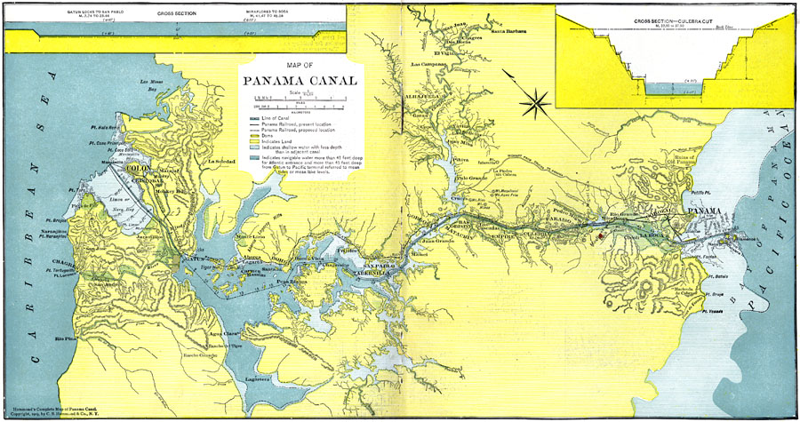
Description: A map from 1911 of the Panama Canal, showing the line of the canal with the miles from Colon given (49 miles from Colon to Panama City), the existing and proposed location of the Panama Railroad, dams, feeding rivers and mountains, towns and roads, and water depths. The water depths are color–coded to show shallow water with less depth than the adjacent canal, and navigable water more than 41 feet deep for the Atlantic entrance and more than 45 feet deep from Gatun to Pacific terminal, referred to mean tides or lake levels.
Place Names: Panama, Colon, �Panama, �Mamei, �Pihiva, �Parais
ISO Topic Categories: planningCadastre,
oceans,
location,
inlandWaters,
transportation,
boundaries
Keywords: Panama Canal, political, �physical, �transportation, physical features, local jurisdictions, water routes,
roads,
railroads, planningCadastre,
oceans,
location,
inlandWaters,
transportation,
boundaries, Unknown, 1911
Source: C. S. Hammond, Hammond's Pictorial Atlas of the World (New York, NY: C. S. Hammond & Company, 1911) 4-5
Map Credit: Courtesy the private collection of Roy Winkelman |
|