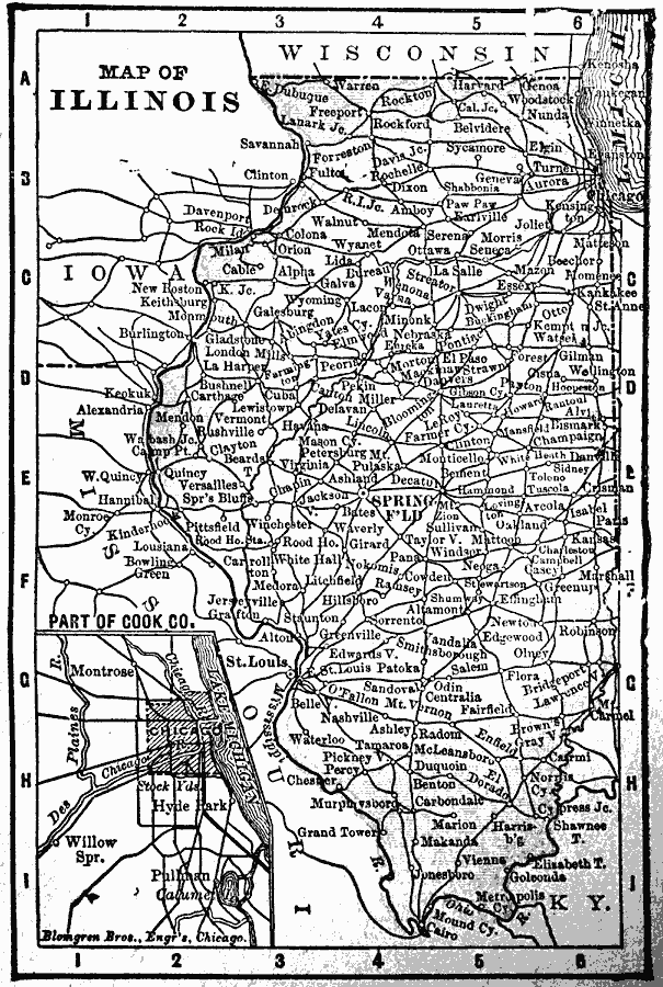
Description: A map from 1902 of Illinois showing the State capital of Springfield, major cities and towns, railroads, canals, the shoreline of Lake Michigan, and the Mississippi and Ohio rivers. An inset map shows the vicinity of Chicago.
Place Names: Illinois, Chicago, �Illinois, �Springfiel
ISO Topic Categories: boundaries,
inlandWaters,
location,
oceans
Keywords: Illinois, physical, �political, �borders, �boundaries, physical features, country borders, boundaries,
inlandWaters,
location,
oceans, Unknown, 1902
Source: George W. Conklin, The New Conklin's Handy Manual of Useful Information and Atlas of the World (Chicago, IL: The Christian Herald, 1902) 383
Map Credit: Courtesy the private collection of Roy Winkelman |
|