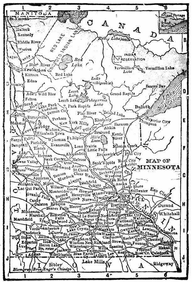
Description: A map from 1902 of Minnesota showing the capital of St. Paul, major cities and towns, the Red Lake Indian Lands, railroads, lakes, and rivers, including the headwaters of the Mississippi River.
Place Names: Minnesota, Duluth, �Minneapolis, �Minnesota, �St. Pau
ISO Topic Categories: boundaries,
inlandWaters,
location,
oceans
Keywords: Minnesota, physical, �political, �borders, �boundaries, kNativeAmerican,physical features, country borders, boundaries,
inlandWaters,
location,
oceans, Unknown, 1902
Source: George W. Conklin, The New Conklin's Handy Manual of Useful Information and Atlas of the World (Chicago, IL: The Christian Herald, 1902) 403
Map Credit: Courtesy the private collection of Roy Winkelman |
|