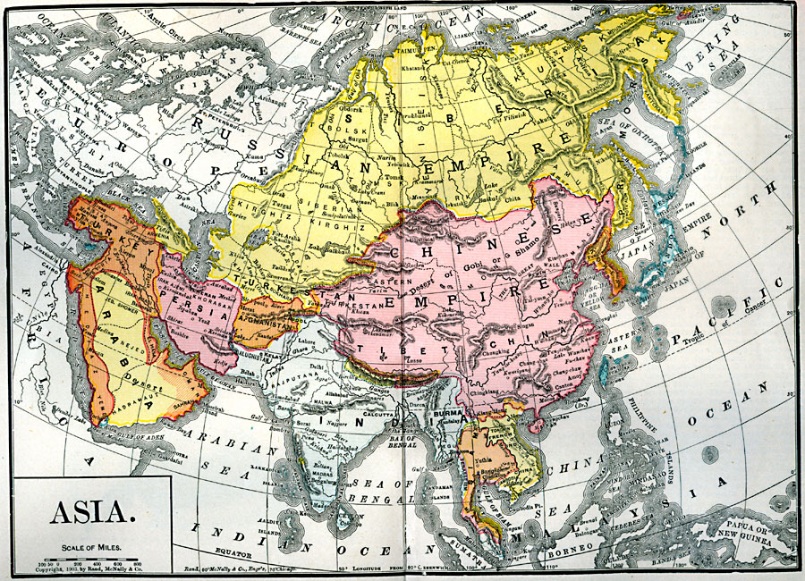
Description: A map of Asia from 1903 showing country boundaries at the time, major cities, rivers, lakes, terrain, and coastal features. This map shows the extent of the Russian Empire and Turkish Ottoman Empire in Asia, the Empire of Japan and Chinese Empire, foreign possessions, and the Great Wall of China.
Place Names: A Complete Map of Asia, China, �Russia, �Burma, �French Indochina, �Siam, �Thailand, �Japan, �Arabia, �Turkey, �Persia, �Afghanistan, �India, �Ceylon, �Sri Lanka, �Korea,�Russian Empire, �Chinese Empire
ISO Topic Categories: boundaries,
oceans,
inlandWaters,
location
Keywords: Asia, physical, �political, �transportation, physical features, country borders, boundaries,
oceans,
inlandWaters,
location, Unknown, 1903
Source: L. Brent Vaughan, Hill's Practical Reference Library of General Knowledge (Chicago, IL: Dixon, Hanson, & Company, 1906) tab 5
Map Credit: Courtesy the private collection of Roy Winkelman |
|