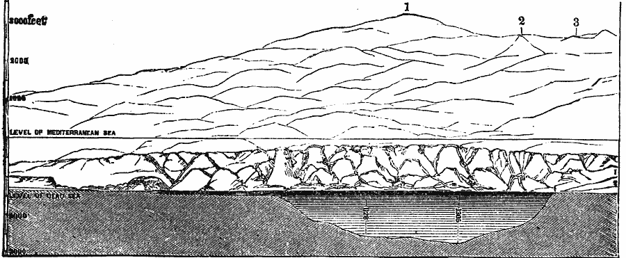
Description: A chart from 1881 of a longitudinal section of the Dead Sea from north to south, viewing from the east shore towards the west. The chart shows the Mediterranean Sea level, the level of the Dead Sea, depths of the sea, and is keyed to show 1. Frank Mountain (Jebel Fureidis), 2. Bethlehem, and 3. Jerusalem.
Place Names: Israel, Dead Sea, �Bethlehem, �Jerusale
ISO Topic Categories: inlandWaters,
location
Keywords: Cross–Section of the Dead Sea, physical, physical features, inlandWaters,
location, Unknown, 1881
Source: W. H. De Puy, People's Cyclopedia of Universal Knowledge Vol 1 (New York, NY: Phillips & Hunt, 1881) 538
Map Credit: Courtesy the private collection of Roy Winkelman |
|