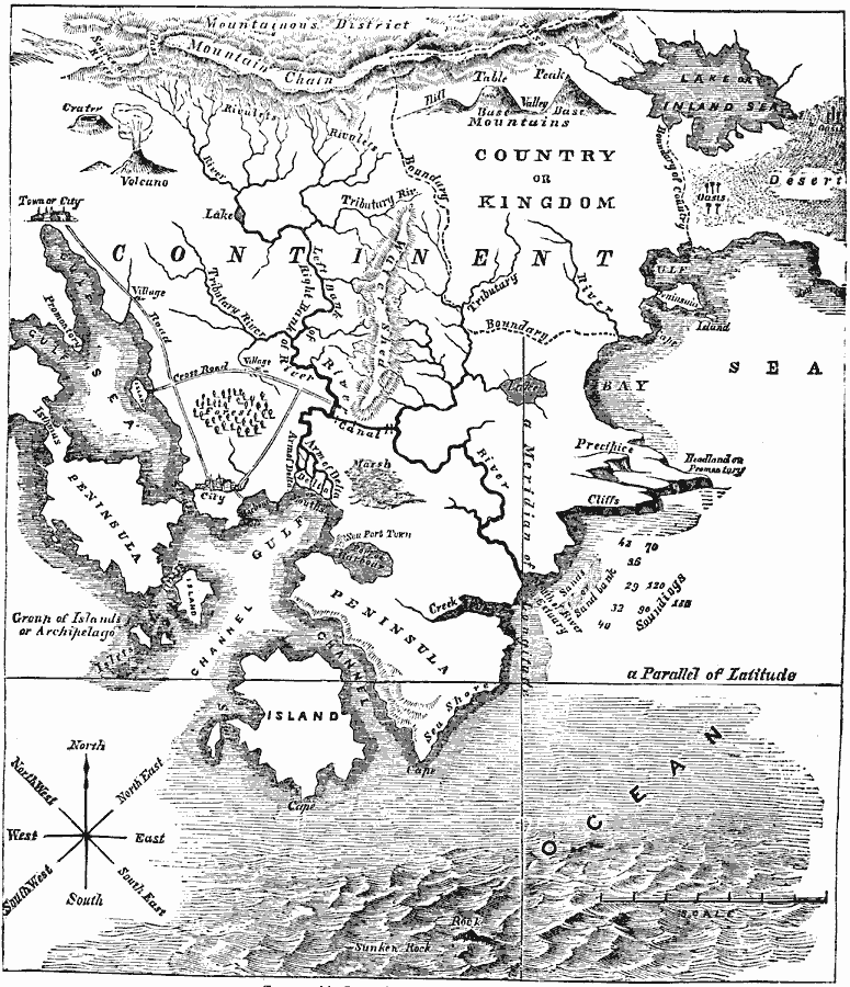
Description: A map from 1881 illustrating common terms used in geography, and their pictorial representations. This chart illustrates the terms mountainous district, mountain chain, (mountain) pass, crater, volcano, hill, table (plateau), peak, (mountain) base, valley, river source, watershed, rivulet, river, tributary river, river bank, creek, canal, river mouth, delta, lake or inland sea, gulf, bay, sea, channel, ocean, sands or sand bank, port or harbor, peninsula, headlands or promontory, cape, precipice, cliffs, isthmus, island, archipelago, sea shore, desert, oasis, marsh, forest, country boundaries, city, town, village, road, crossroad, compass rose (with points of direction), Parallel of Latitude, Meridian of Longitude, soundings, and map scale.
Place Names: Map Drawing, geologic formations, �geograph
ISO Topic Categories: boundaries,
geoscientificInformation,
transportation,
inlandWaters,
oceans
Keywords: Typical Geographical Map Features, physical, �political, �transportation, physical features, local jurisdictions, roads, boundaries,
geoscientificInformation,
transportation,
inlandWaters,
oceans, Unknown, 1881
Source: W. H. De Puy, People's Cyclopedia of Universal Knowledge Vol 1 (New York, NY: Phillips & Hunt, 1881) 789
Map Credit: Courtesy the private collection of Roy Winkelman |
|