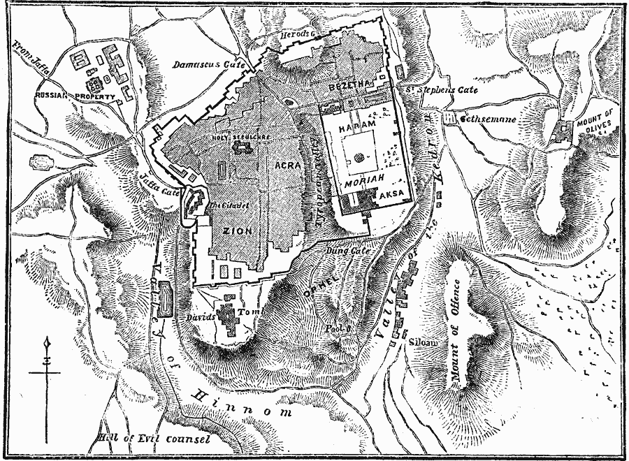
Description: A map from 1881 of Jerusalem, showing historical sites within the city walls, important city gates, roads, and neighboring sites, including David's Tomb, Mount of Olives and the Russian Property (Russian Orthodox Church compound) to the west towards Jaffa. The map uses hatchers to show terrain features and topography, including the Mount of Offence, Hill of Evil Counsel, Valley of Hinnom, Valley of the Kedron, and Tyropean Valley.
Place Names: Israel, Jerusale
ISO Topic Categories: transportation,
society,
location,
inlandWaters
Keywords: Jerusalem, physical, �political, �transportation, physical features,
topographical, local jurisdictions, roads, transportation,
society,
location,
inlandWaters, Unknown, 1881
Source: W. H. De Puy, People's Cyclopedia of Universal Knowledge Vol 1 (New York, NY: Phillips & Hunt, 1881) 996
Map Credit: Courtesy the private collection of Roy Winkelman |
|