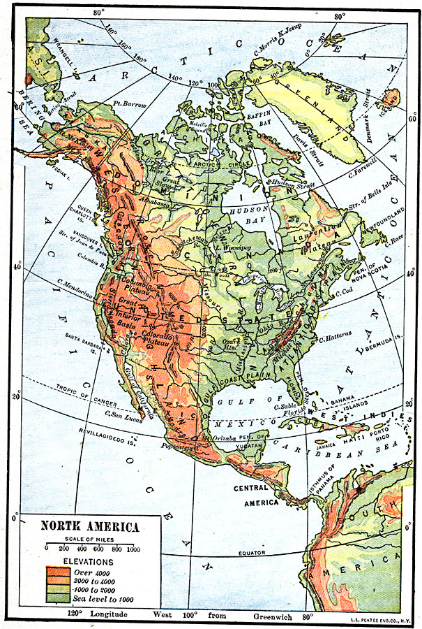
Description: A map from 1920 of North America, Central America, Greenland, and the Caribbean showing general land elevations, water and principal terrain features. The map uses color–contouring to show land elevations from sea level to over 4000 feet. The principal highlands, mountain systems, plains, river systems, and coastal features are shown.
Place Names: A Complete Map of North America, United States, �Mexico, �Cuba, �Canada, �Bahama
ISO Topic Categories: boundaries,
oceans,
location,
inlandWaters
Keywords: North America, physical, �political, physical features, country borders, boundaries,
oceans,
location,
inlandWaters, Unknown, 1920
Source: Robert Hall, Harriet Smither, and Clarence Ousley, A History of the United States (Dallas, TX: The Southern Publishing Company, 1920) 3
Map Credit: Courtesy the private collection of Roy Winkelman |
|