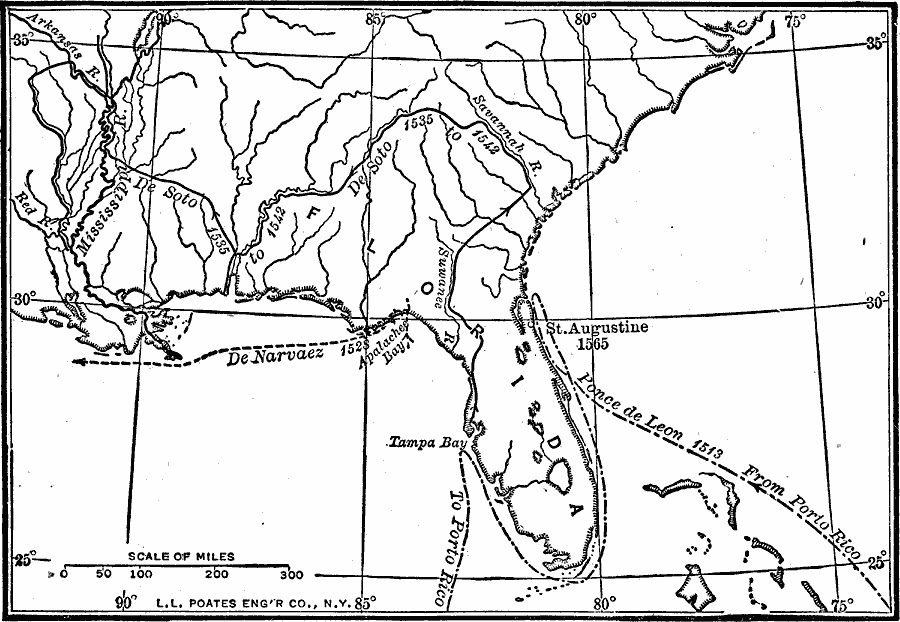
Description: A map of southern North America, Florida, and the Gulf of Mexico east the Mississippi Delta showing the routes of the early Spanish explorers Ponce de Leon (1513), De Narvaez (1528), and Hernando de Soto (1535–1542).
Place Names: Early America 1400-1800, Florida, �Tampa Bay, �St. Augustine, �Discovery, �Spanis
ISO Topic Categories: transportation,
inlandWaters,
location,
oceans
Keywords: Routes of Spanish Explorers, physical, �transportation, physical features, water routes, transportation,
inlandWaters,
location,
oceans, Unknown, 1513–1565
Source: Robert Hall, Harriet Smither, and Clarence Ousley, A History of the United States (Dallas, TX: The Southern Publishing Company, 1920) 27
Map Credit: Courtesy the private collection of Roy Winkelman |
|