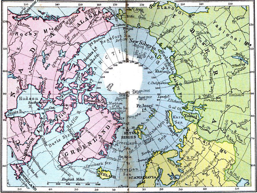
Description: A map from 1920 of the Arctic region of the world. The map is color–coded to show the North American lands in pink, Asian lands in green, and European lands in yellow. The map shows the northernmost points with dates reached by several arctic explorers, several prominent mountain peaks in the region with elevations given in feet above sea level, major cities, rivers, and coastal features.
Place Names: Arctic Region, North America, �Europe, �Asi
ISO Topic Categories: boundaries,
location,
inlandWaters,
oceans
Keywords: Arctic Regions, physical, �political, physical features, country borders, boundaries,
location,
inlandWaters,
oceans, Unknown, 1920
Source: , Asprey's Atlas of the World (London, England: Asprey and Co., Ltd., 1920) 10
Map Credit: Courtesy the private collection of Roy Winkelman |
|