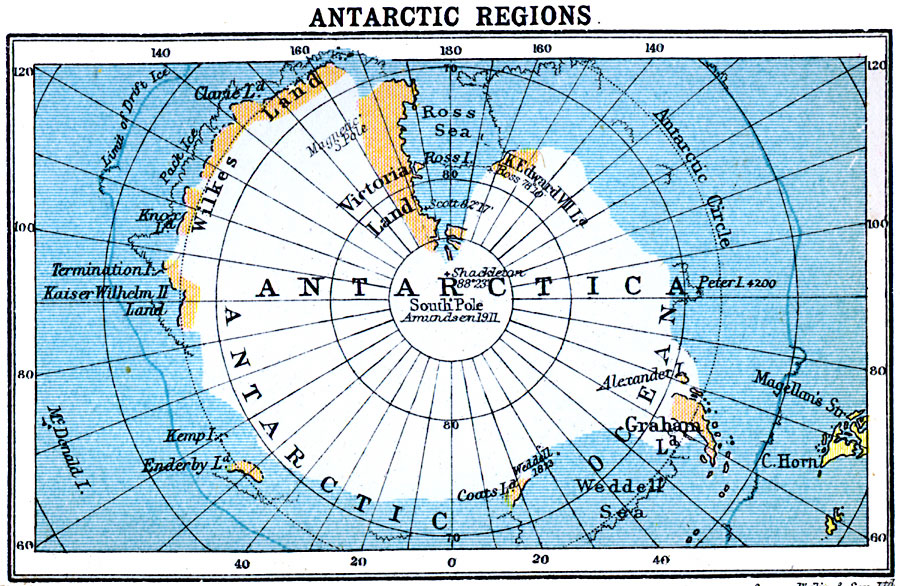
Description: A map of Antarctica from 1920 showing the extent of known land at the time. The map shows the geographic and magnetic poles, the extent of pack ice, limit of drift ice, and the southernmost points reached by Wendell in 1823, Ross in 1841, Scott on his first voyage in 1902, Shackleton in 1909, and Amundsen reaching the pole in 1911.
Place Names: Antarctic Region, Antarctica, �Afric
ISO Topic Categories: location,
oceans
Keywords: Antarctic Regions, physical, physical features, location,
oceans, Unknown, 1920
Source: , Asprey's Atlas of the World (London, England: Asprey and Co., Ltd., 1920) 11
Map Credit: Courtesy the private collection of Roy Winkelman |
|