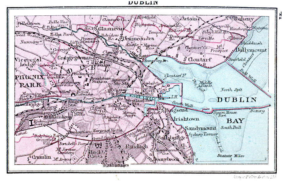
Description: A map of Dublin, Ireland, in 1920, showing major streets and roads, canals, railways, city boundary, and neighboring towns. The map shows historical landmarks, contour–colored detail of water depth in Dublin Bay, the harbor walls (jetties), light house, and the River Liffey.
Place Names: Ireland, Dubli
ISO Topic Categories: transportation,
location,
oceans,
inlandWaters
Keywords: Dublin, physical, �transportation, physical features, roads,
railroads, transportation,
location,
oceans,
inlandWaters, Unknown, 1920
Source: , Asprey's Atlas of the World (London, England: Asprey and Co., Ltd., 1920) 41
Map Credit: Courtesy the private collection of Roy Winkelman |
|