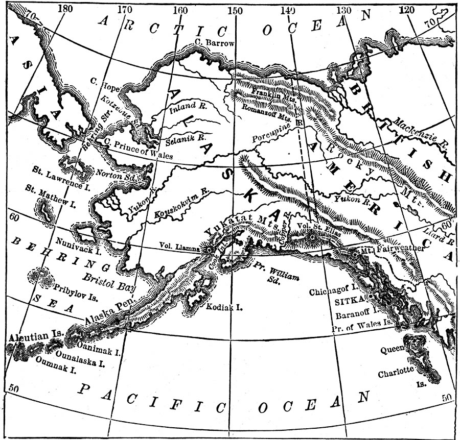
Description: A map of Alaska from 1873 showing the State capital at Sitka, cities, towns, ports, major rivers and mountain systems, coastal features, and islands.
Place Names: Alaska, Sitka, �Aleutian Islands, �Queen Charlotte Island, �Rocky Mountains, �Behring Sea, �Behring Straight, �Yukon River,
ISO Topic Categories: location,
inlandWaters,
oceans
Keywords: Alaska, physical, physical features, location,
inlandWaters,
oceans, Unknown, 1873
Source: D. M. Warren, Elementary Treatise on Physical Geography (Philadelphia, PA : Cowperthwait and Co., 1873) 108
Map Credit: Courtesy the private collection of Roy Winkelman |
|