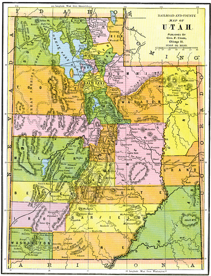
Description: A map from 1892 of the Utah Territory prior to statehood (January 4, 1896), showing the territorial capital at Salt Lake City, counties and county seats, principal cities and towns, railroads, mountains, rivers, and the Great American Desert to the west of Salt Lake.
Place Names: Utah, Salt Lake City, �Corinne, �Provo, �Deseret, �Parowan, �St. Georg
ISO Topic Categories: boundaries,
inlandWaters,
location,
transportation
Keywords: the Utah Territory, physical, �political, �transportation, physical features, county borders, railroads, boundaries,
inlandWaters,
location,
transportation, Unknown, 1892
Source: , The American Republic (Chicago, IL: John W. Iliff and Co., 1892) 74
Map Credit: Courtesy the private collection of Roy Winkelman |
|