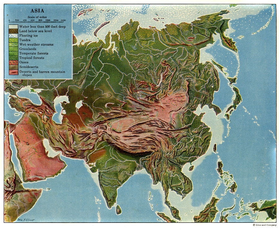
Description: A color–relief map from 1920 of Asia showing the principal landform and vegetation features, river systems, and water features of the region. The map is keyed to show areas of waters less than 500 feet deep, floating ice, lands below sea level, tundra, grasslands, temperate and tropical forests, oases, semi–deserts, and regions of deserts and barren mountain slopes.
Place Names: A Complete Map of Asia, Japan, �India, �Chin
ISO Topic Categories: inlandWaters,
location,
oceans
Keywords: Land Regions of Asia, physical, physical features, inlandWaters,
location,
oceans, Unknown, 1920
Source: Wallace W. Atwood, New Geography: Book Two (Boston, MA: Ginn and Company, 1920) Between 256 and 257
Map Credit: Courtesy the private collection of Roy Winkelman |
|