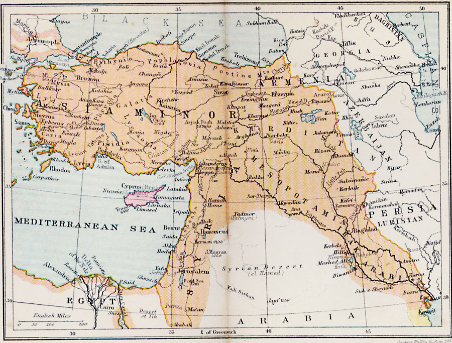
Description: A map from 1920 of Asia Minor, showing the extent of the Turkish Ottoman Empire in the region at the time, from Constantinople on the Bosporus to the Persian Gulf, and along the Mediterranean to Ghuzzeh (Gaza). Major cities, railroads, terrain, rivers, coastal features, and islands of the region are shown. The map shows the island of Cyprus as a British possession.
Place Names: Southwest Asia, Adrianople, �Brussa, �Mysia, �Doris, �Cyprus, �Alexandria, �Trebizond, �Jerusalem, �Beirut, �Mosul, �Baghdad, �Hillel, �Tripol
ISO Topic Categories: boundaries,
inlandWaters,
location,
oceans
Keywords: Turkey in Asia, physical, �political, physical features, country borders, boundaries,
inlandWaters,
location,
oceans, Unknown, 1920
Source: , Asprey's Atlas of the World (London, England: Asprey and Co., Ltd., 1920) 80
Map Credit: Courtesy the private collection of Roy Winkelman |
|