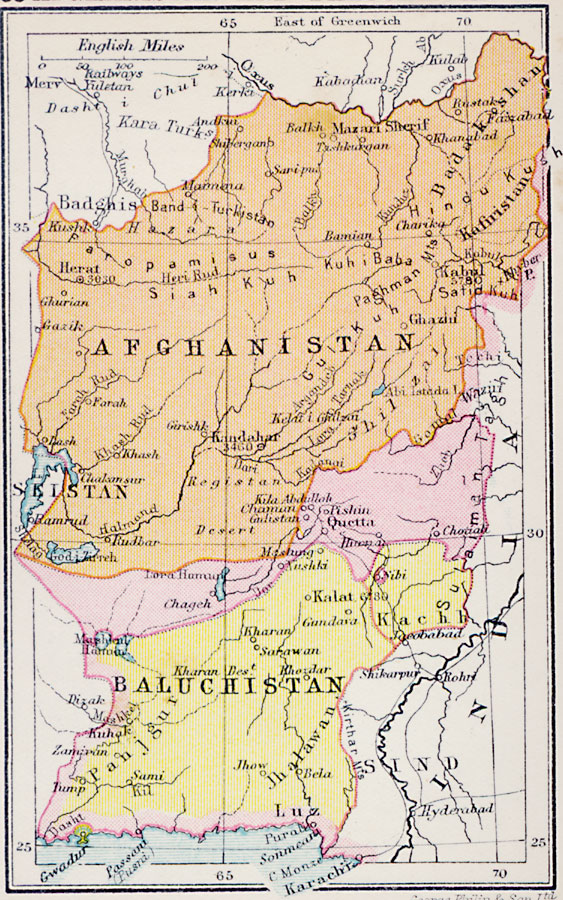
Description: A map from 1920 of Afghanistan and Baluchistan. At this time, Baluchistan was part of British India, and the map shows the districts of Baluchistan, Kachh, and the British controlled district around Quetta. Baluchistan became part of Pakistan in 1947. The map shows major cities in the region, rivers, lakes, mountain systems, and coastal features. Elevations for the Afghan cities of Kabul, Heart, and Kandahar are given, and the port of Gwandur under Oman or Muscat control is shown.
Place Names: Western Asia, Afghanistan, �Seistan, �Baluchistan, �Herat, �Mazari Sherif, �Kandahar, �Quetta, �Kalat, �Kabu
ISO Topic Categories: boundaries,
inlandWaters,
location,
oceans,
transportation
Keywords: Afghanistan and Baluchistan, physical, �political, �transportation, physical features, country borders, railroads, boundaries,
inlandWaters,
location,
oceans,
transportation, Unknown, 1920
Source: , Asprey's Atlas of the World (London, England: Asprey and Co., Ltd., 1920) 83
Map Credit: Courtesy the private collection of Roy Winkelman |
|