mapsMaps ETC Site map
 Maps ETC > Globes and Multi-continent > A Complete Map of Globes and Multi-continent > World Map on Mercator's Projection, 1922
Site Map 

World Map on Mercator's Projection, 1922

World Map on Mercator's Projection


Title: World Map on Mercator's Projection
Projection: Unknown,
Source Bounding Coordinates:
W: -110 E: 105 N: 80 S: -70

Main Map Page
Zoomify Version
B/W PDF Version
Color PDF Version
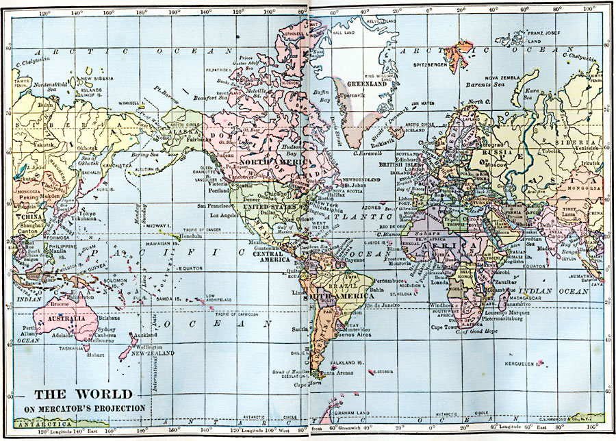
Description: A world map from 1922 on a Mercator's Projection, showing national boundaries and major cities of the time.
Place Names: A Complete Map of Globes and Multi-continent, Africa, Antarctica, Asia, Australia, Europe, North America, South Americ
ISO Topic Categories: inlandWaters, location, oceans
Keywords: World Map on Mercator's Projection, physical, kMapProjection, physical features, inlandWaters, location, oceans, Unknown, 1922
Source: , Putnam's Handy Map Book (New York, New York: G. P. Putnam's Sons, 1922) 8-9
Map Credit: Courtesy the private collection of Roy Winkelman
SearchLicensePDF HelpGIS Help Google Earth Help Zoomify Help

 Maps ETC > Globes and Multi-continent > A Complete Map of Globes and Multi-continent > World Map on Mercator's Projection, 1922
Site Map