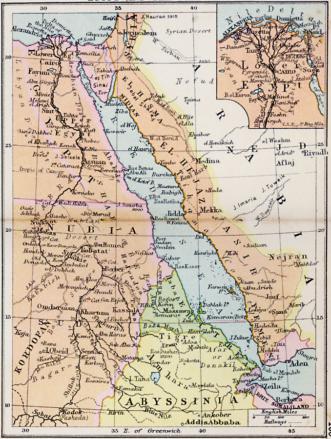
Description: A map of Egypt and the Nile Valley from the delta south to the confluence of the Sobat River and the Upper Nile. This map shows Egypt Proper, Nubia, Kordofan, Sudan, Eritrea, and portions of Abyssinia and British Somalia. The map also shows the Red Sea and the Arabian Peninsula countries of El Hishma, El Hejaz, Asir, and Yemen. Major cities, trade centers, ports, railways, river tributaries, and native group names are shown. The inset map details the Nile Delta, showing Cairo, Port Said, the Suez Canal, and railroads of the area.
Place Names: Egypt, Yemen, �Aden, �Midian, �El Hisma, �Syria, �Cairo, �Mahas, �Berber, �Abyssinia, �Addis Abbaba, �Zeila, �Eritre
ISO Topic Categories: boundaries,
inlandWaters,
location,
oceans,
transportation
Keywords: Egypt and the Nile Valley, physical, �political, �transportation, physical features, country borders, railroads, boundaries,
inlandWaters,
location,
oceans,
transportation, Unknown, 1920
Source: , Asprey's Atlas of the World (London, England: Asprey and Co., Ltd., 1920) 100
Map Credit: Courtesy the private collection of Roy Winkelman |
|