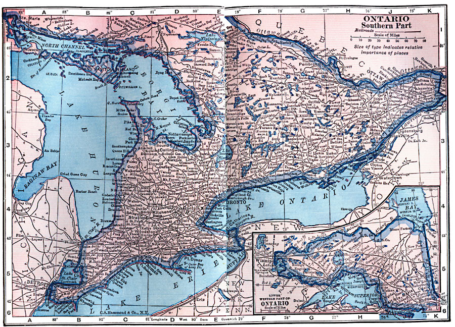
Description: A map from 1922 of the province of Ontario with an inset map of the northwestern part of the province. The map shows the Canadian capital of Ottawa, the province capital of Toronto, major cities and towns, railways, lakes and rivers of the province.
Place Names: Canada, Ontario, �Ottaw
ISO Topic Categories: boundaries,
inlandWaters,
location,
transportation
Keywords: Ontario, physical, �transportation, physical features, railroads, boundaries,
inlandWaters,
location,
transportation, Unknown, 1922
Source: , Putnam's Handy Map Book (New York, NY: G. P. Putnam's Sons, 1922) 70-71
Map Credit: Courtesy the private collection of Roy Winkelman |
|