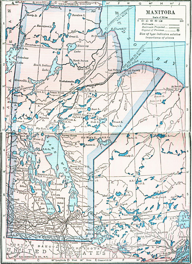
Description: A map from 1922 of Manitoba showing the provincial capital of Winnipeg, major cities and towns, existing and proposed railroads, terrain features, lakes, and rivers. The map shows the province boundaries after to the territorial expansion in 1912 north to the Hudson Bay. The map shows the Hudson Bay ports of Fort Churchill and Port Nelson, with steamship access to Liverpool England.
Place Names: Canada, Manitoba, �Winnipe
ISO Topic Categories: boundaries,
inlandWaters,
location,
transportation
Keywords: Manitoba, physical, �transportation, physical features, railroads, boundaries,
inlandWaters,
location,
transportation, Unknown, 1922
Source: , Putnam's Handy Map Book (New York, NY: G. P. Putnam's Sons, 1922) 72-73
Map Credit: Courtesy the private collection of Roy Winkelman |
|