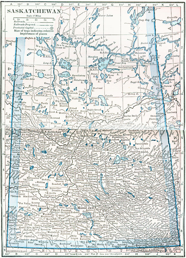
Description: A map from 1922 of the province of Saskatchewan, showing the provincial capital of Regina, major cities and towns, existing and proposed railways, Hudson Bay Company outposts, terrain features, lakes, and rivers.
Place Names: Canada, Saskatchewan, �Regina, �Moose Jaw, �Saskatoon,
ISO Topic Categories: boundaries,
inlandWaters,
location,
transportation
Keywords: Saskatchewan, physical, �transportation, physical features, railroads, boundaries,
inlandWaters,
location,
transportation, Unknown, 1922
Source: , Putnam's Handy Map Book (New York, NY: G. P. Putnam's Sons, 1922) 74-75
Map Credit: Courtesy the private collection of Roy Winkelman |
|