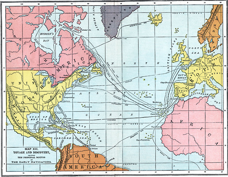
Description: A map of the Atlantic Ocean showing the early European voyages of discovery to the New World, from Lief Erickson (1001) to Bartholomew Gosnold (1602), and shows the routes of Columbus (1492), Cabot (1497), De Gama (1498), Magellan (1519), and others.
Place Names: Regional Atlantic Ocean, sweden, africa, south america, north america�Europ
ISO Topic Categories: physical, �political, �transportation, �historical, kWorldAtlantic, kWorldAmericas
Keywords: Voyage and Discovery, physical, �political, �transportation, �historical, physical features, country borders, water routes, historical event, physical, �political, �transportation, �historical, kWorldAtlantic, kWorldAmericas, Unknown, AD 1000–1650
Source: John Clark Ridpath, L.L. D, Cyclopedia of Universal History (Cincinnati, OH: The Jones Brothers Publishing Co., 1885) 551
Map Credit: Courtesy the private collection of Roy Winkelman |
|