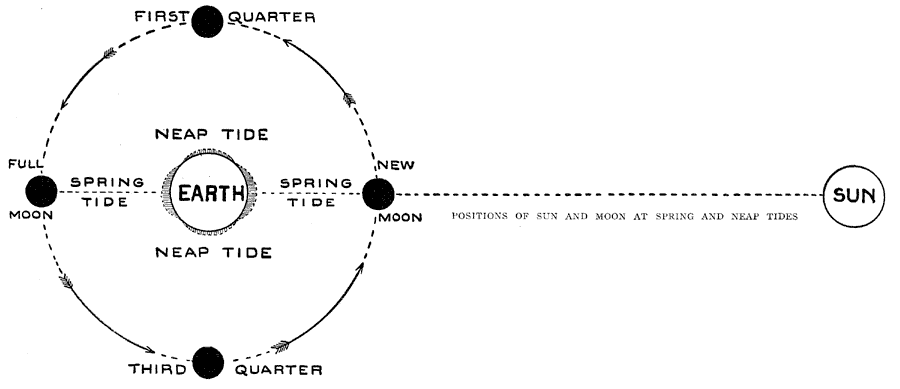
Description: The relative positions of the Earth and the Moon and their relation to tides.
Place Names: A Regional Map of Astronomical, Earth, �Moo
ISO Topic Categories:
Keywords: The Moon and Tides, the earth and the moon relative position tides, neap tide, spring tide, first quarter, third quarter, new moon, full moon, Unknown, 1917
Source: Francis J. Reynolds, The New Encyclopedic Atlas and Gazetteer of the World (New York, New York: P. F. Collier and Son, 1917) 84
Map Credit: Courtesy the private collection of Roy Winkelman |
|