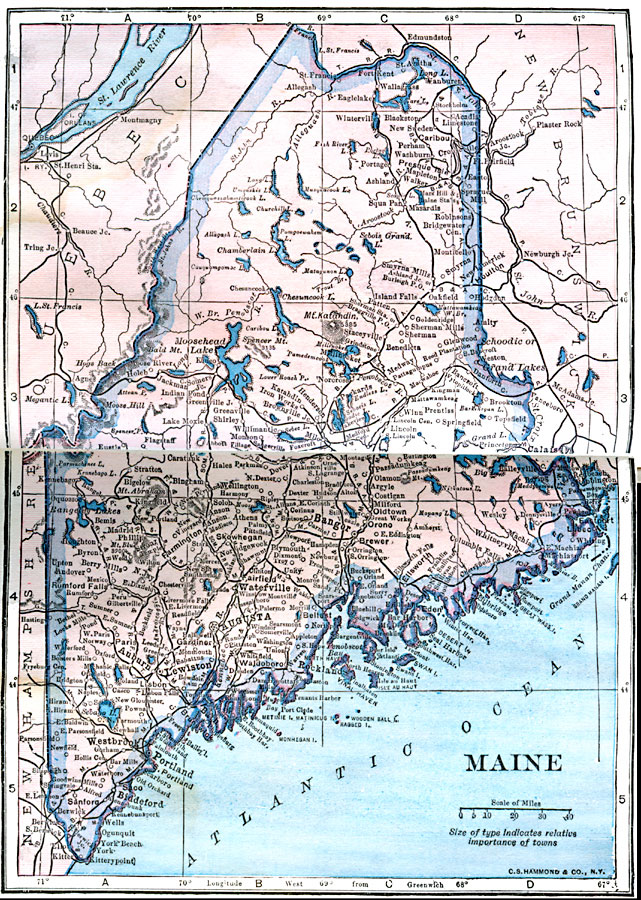
Description: A map from 1922 of Maine showing the State capital of Augusta, major cities, towns and ports, railroads, mountains, lakes, rivers, and coastal features.
Place Names: Maine, Augusta, �Lewiston, �Biddeford, �Portland, �Ellsworth, �Whitneyvill
ISO Topic Categories: boundaries,
inlandWaters,
location,
oceans
Keywords: Maine, physical, physical features, boundaries,
inlandWaters,
location,
oceans, Unknown, 1922
Source: , Putnam's Handy Map Book (New York, NY: G. P. Putnam's Sons, 1922) 214-215
Map Credit: Courtesy the private collection of Roy Winkelman |
|