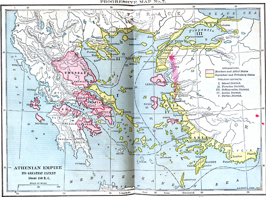
Description: Map of Greece and Asia Minor showing the Athenian Empire at its greatest extent, around 450 BC. This map is color–coded to show the territories of the members of the allied states, and the dependent and tributary states, and has numeric references to the Island, Thracian, Hellespontine, Ionian, and Carian tributary districts.The map also shows the non–aligned territories of the Peloponnese and southern Balkan peninsulas, and islands.
Place Names: Greece, Achaia, �Argolis, �Athens, �Attica, �Beotia, �Caria, �Ionia, �Lesbos, �Locris, �Phocis, �Thessal
ISO Topic Categories: oceans,
location,
inlandWaters
Keywords: Athenian Empire - Its Greatest Extent, borders, �political, �historical, kAncientGreece, major political subdivisions, other military, oceans,
location,
inlandWaters, Unknown, 450 B.C.
Source: William C. Morey, Outlines in Greek History with a survey of Ancient Oriental Nations (New York, NY: The Athenium Press, 1908) 214-215
Map Credit: Courtesy the private collection of Roy Winkelman |
|