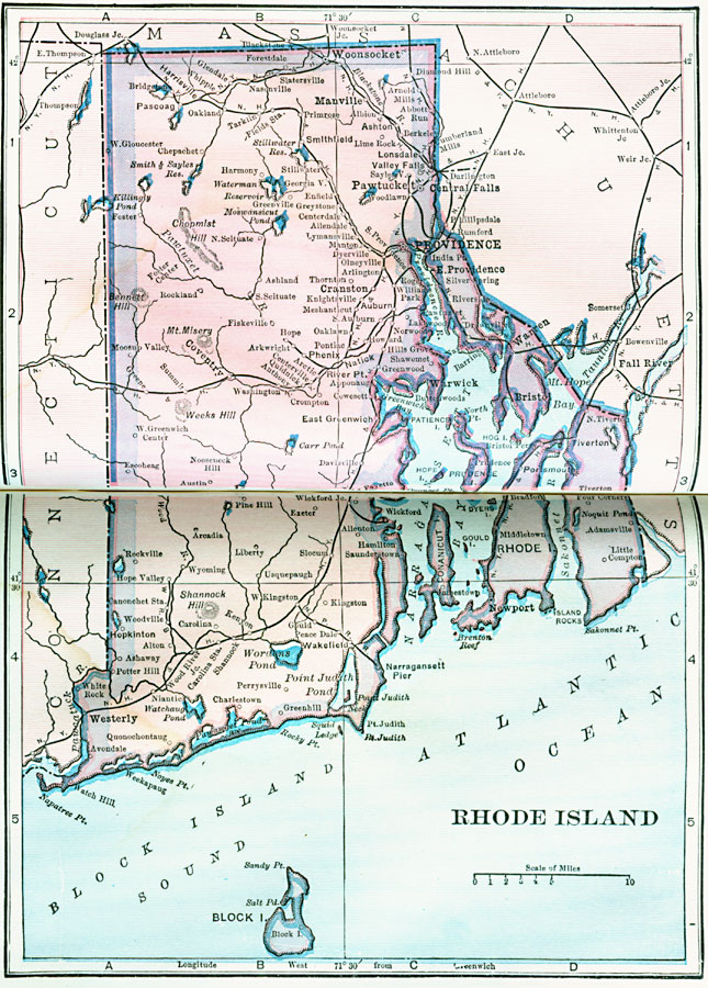
Description: A map from 1922 of Rhode Island showing the capital at Providence, principal cities, towns, and ports, railroads, terrain, lakes, rivers, and coastal features.
Place Names: Rhode Island, Greenwich, �Warwick, �Woonsocket, �Providence, �Warren, �Bristol, �Newport, �Pawtucket, �Narragansett Pie
ISO Topic Categories: boundaries,
location,
inlandWaters,
oceans
Keywords: Rhode Island, physical, physical features, boundaries,
location,
inlandWaters,
oceans, Unknown, 1922
Source: , Putnam's Handy Map Book (New York, NY: G. P. Putnam's Sons, 1922) 288-289
Map Credit: Courtesy the private collection of Roy Winkelman |
|