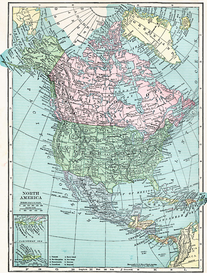
Description: A map from 1920 of North America, Central America, Greenland, and Caribbean showing national, state, and province boundaries, capitals and major cities, railroads, submarine telegraph cables, mountain systems, rivers, and coastal features. Inset maps detail the Caribbean islands of St. Thomas, St. John, and St. Croix.
Place Names: A Complete Map of North America, Bahamas, �Canada, �Cuba, �Mexico, �United States, �St. Thomas Island, �St. John Island, �St. Croix Island,
ISO Topic Categories: boundaries,
location,
inlandWaters,
oceans
Keywords: North America, physical, physical features, boundaries,
location,
inlandWaters,
oceans, Unknown, 1920
Source: , Hammond's Modern Atlas of the World (New York, NY: C. S. Hammond and Company, Inc., 1920) 2
Map Credit: Courtesy the private collection of Roy Winkelman |
|