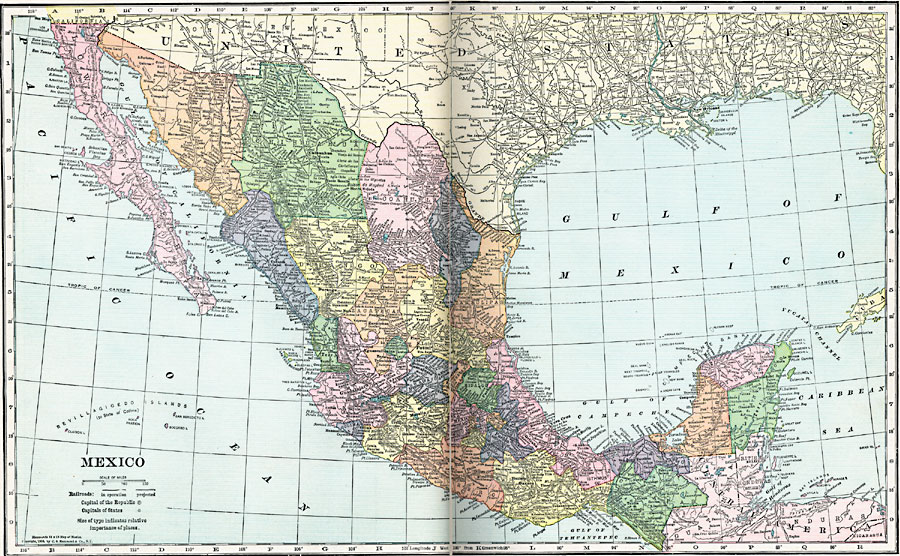
Description: A map from 1920 of Mexico showing the states and state capitals, major cities and towns, existing and proposed railroads, mountains, rivers, lakes, and coastal features of the country.
Place Names: Mexico, Merida, �Mexico City, �Salina Cruz, �Veracruz, �Tampico, �Acapulco, �La Paz, �Monterre
ISO Topic Categories: boundaries,
location,
inlandWaters,
oceans,
transportation
Keywords: Mexico, physical, �transportation, physical features, railroads, boundaries,
location,
inlandWaters,
oceans,
transportation, Unknown, 1920
Source: , Hammond's Modern Atlas of the World (New York, NY: C. S. Hammond and Company, Inc., 1920) 20-21
Map Credit: Courtesy the private collection of Roy Winkelman |
|