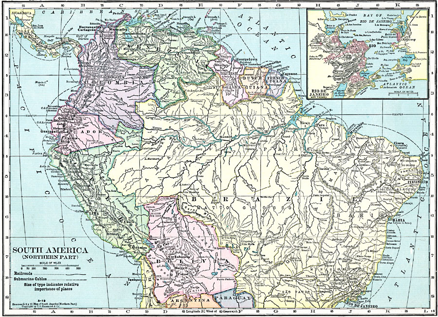
Description: A map from 1920 of the northern part of South America from the Caribbean Sea south the Rio de Janeiro. The map shows the political boundaries at the time for Panama, Columbia, Venezuela, British, Dutch, and French Guiana, Ecuador, Peru, and Bolivia, the northern portion of Brazil, and portions of Chile, Argentina, and Paraguay. The map shows capitals and major cities, towns, ports, railroads, submarine telegraph cables, rivers, terrain, and coastal features. An inset map details Rio de Janeiro and the Bay of Rio de Janeiro on the Atlantic coast of Brazil.
Place Names: A Regional Map of South America, Peru, �Venezuela, �Columbia, �Brazil, �Paraguay, �Argentina, �Bolivia, �Chile, �Ecuador, �British Guiana, �Dutch Guiana, �French Guiana, �Rio De Janeiro,
ISO Topic Categories: boundaries,
location,
inlandWaters,
oceans,
transportation
Keywords: Northern South America, physical, �transportation, physical features, railroads, boundaries,
location,
inlandWaters,
oceans,
transportation, Unknown, 1920
Source: , Hammond's Modern Atlas of the World (New York, New York: C. S. Hammond and Company, Inc., 1920) 24
Map Credit: Courtesy the private collection of Roy Winkelman |
|