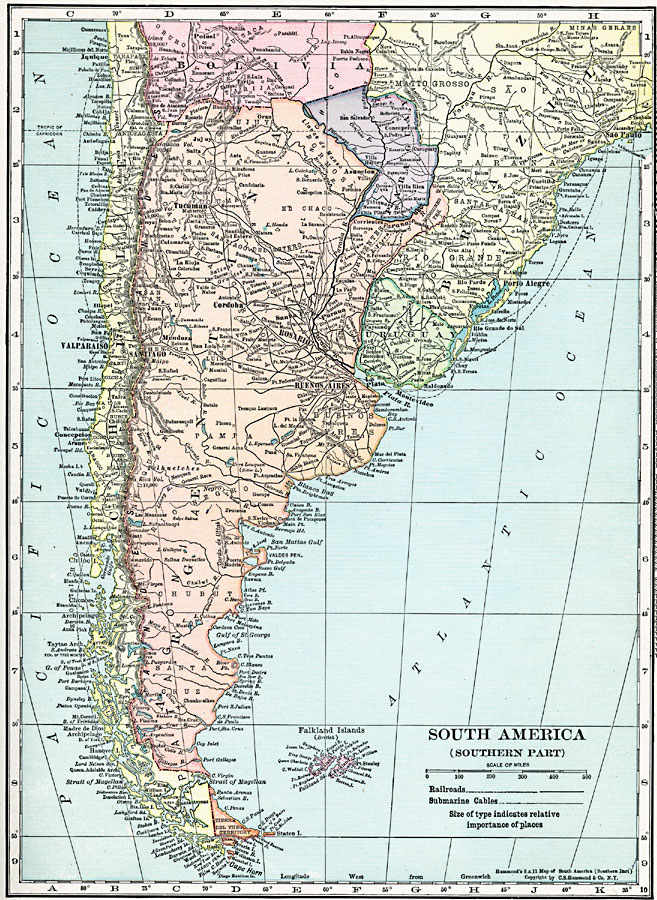
Description: A map from 1920 of the southern part of South America from Sao Paulo on the Atlantic and Iquique on the Pacific south to Tierra del Fuego. The map shows the political boundaries at the time for Argentina, Paraguay, Uruguay, and the southern portions of Chile, Bolivia, and Brazil. Tierra del Fuego is shown as a territory, and the Falkland Islands (Islas Malvinas) as a British possession. The map shows capitals and major cities, towns, ports, railroads, submarine telegraph cables, rivers, terrain, and coastal features.
Place Names: A Regional Map of South America, Argentina, �Chile, �Brazil, �Uraguay, �Paraguay, �Bolivia, �Falkland Islands,
ISO Topic Categories: boundaries,
transportation,
oceans,
location,
inlandWaters
Keywords: Southern South America, physical, �transportation, physical features, railroads, boundaries,
transportation,
oceans,
location,
inlandWaters, Unknown, 1920
Source: , Hammond's Modern Atlas of the World (New York, New York: C. S. Hammond and Company, Inc., 1920) 25
Map Credit: Courtesy the private collection of Roy Winkelman |
|