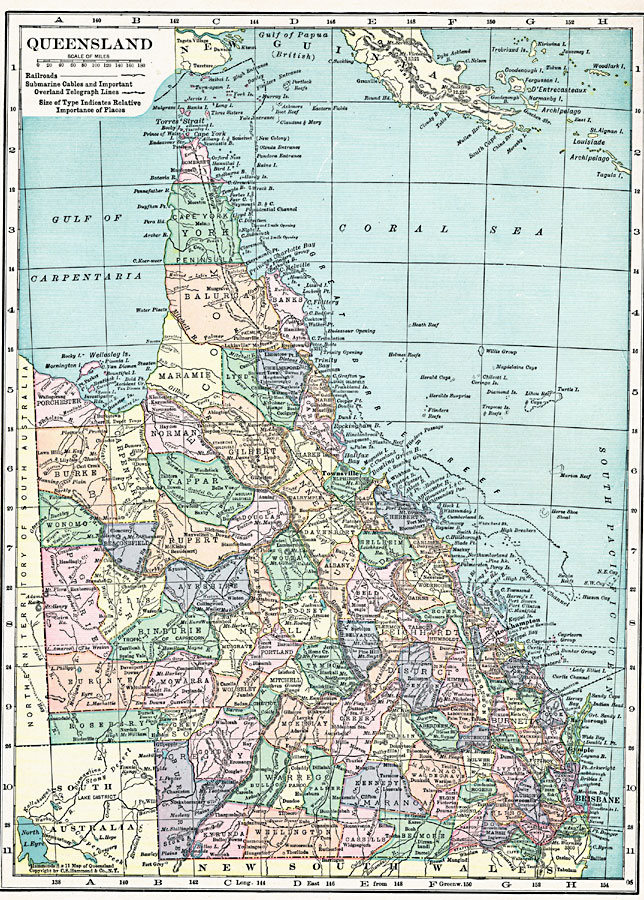
Description: A map of Queensland, Australia in 1920, showing counties, cities and ports, railways, submarine cable and important overland telegraph routes, rivers, lakes, mountains, and coastal features. The map shows the Great Barrier Reef and Torres Straight between Australia and New Guinea.
Place Names: Queensland, Rockhampton, �Brisbane, �Gympie, �Maryboroug
ISO Topic Categories: boundaries,
location,
inlandWaters,
oceans,
transportation
Keywords: Queensland, physical, �transportation, physical features, railroads, boundaries,
location,
inlandWaters,
oceans,
transportation, Unknown, 1920
Source: , Hammond's Modern Atlas of the World (New York, New York: C. S. Hammond and Company, Inc., 1920) 28
Map Credit: Courtesy the private collection of Roy Winkelman |
|