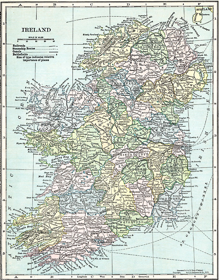
Description: A map of Ireland in 1920 showing major cities, ports, railroads, canals, steamship routes and historic battlefields.
Place Names: Ireland, Dublin, �Cork, �Galway, �Killarney, �Limerick, �Sligo, �Shannon, �Belfast,
ISO Topic Categories: boundaries,
inlandWaters,
location,
oceans,
transportation
Keywords: Ireland, physical, �transportation, physical features, railroads,
water routes, boundaries,
inlandWaters,
location,
oceans,
transportation, Unknown, 1920
Source: , Hammond's Modern Atlas of the World (New York, New York: C. S. Hammond and Company, Inc., 1920) 40
Map Credit: Courtesy the private collection of Roy Winkelman |
|