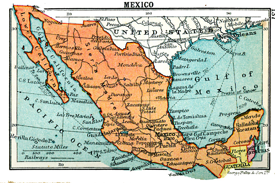
Description: A map from 1920 of Mexico showing major cities and ports, railroads with connections to the railroad network in the United States, shipping routes from New Orleans and San Francisco with distances given in nautical miles, rivers with heads of navigation indicated by an anchor symbol, and the Sierra Madre mountain system with the elevations of prominent peaks given in feet above sea level.
Place Names: Mexico, Alamos, �Durango, �Victoria, �Monterey, �Tampico, �Mexico City, �Morelia, �Puebl
ISO Topic Categories: boundaries,
inlandWaters,
location,
oceans,
transportation
Keywords: Mexico, physical, �political, �transportation, physical features, country borders, railroads, boundaries,
inlandWaters,
location,
oceans,
transportation, Unknown, 1920
Source: , Asprey's Atlas of the World (London, England: Asprey and Co., Ltd., 1920) 137
Map Credit: Courtesy the private collection of Roy Winkelman |
|