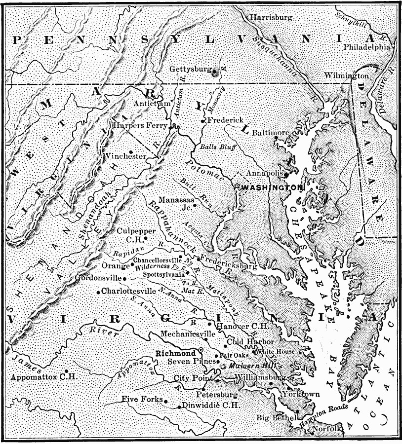
Description: A map showing the area of the American Civil War in the east, including the major battle sites of Bulls Run Creek, Manassas Junction, Fredericksburg, Chancellorsville, Wilderness, Spottsylvania, Mechanicsville, Cold Harbor, Malvern Hill, Petersburg, Balls Bluff, Harpers Ferry, Antietam, Gettysburg, and Appomattox Court House.
Place Names: Civil War, Delaware, �Maryland, �Pennsylvania, �Virginia, �West Virginia, �East, �Eastern,
ISO Topic Categories: oceans,
location,
inlandWaters
Keywords: The War in the East, borders, �political, �historical, country borders, historical event, oceans,
location,
inlandWaters, Unknown, 1861–1865
Source: Gertrude van Duyn Southworth, A First Book in American History (New York, NY: D. Appleton and Co. , 1907) 302
Map Credit: Courtesy the private collection of Roy Winkelman |
|