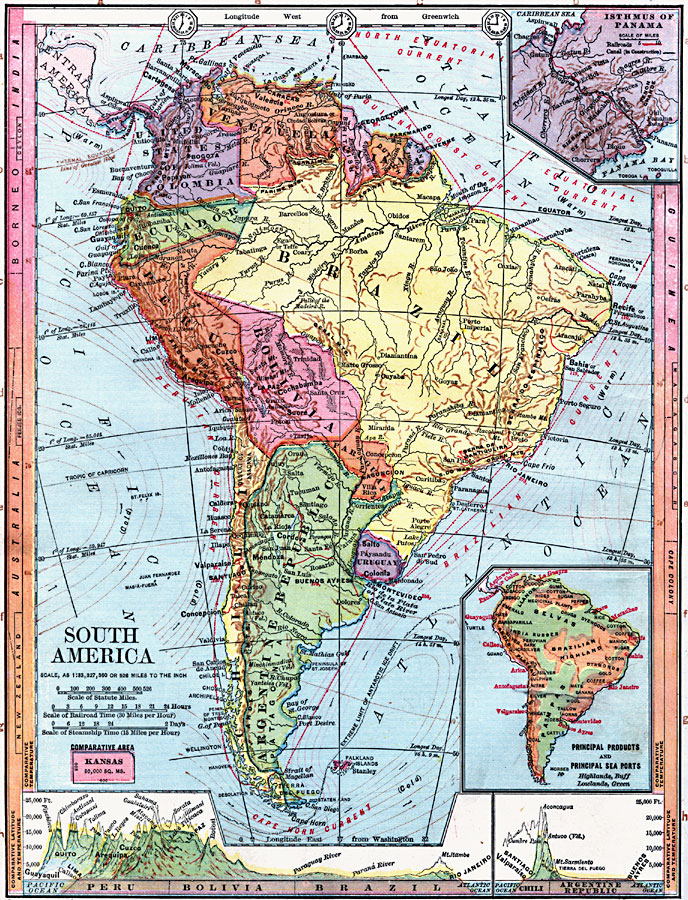
Description: Physical map of South America with map inserts of the Isthmus of Panama and principal products and sea ports of South America. Included are water currents and routes, railroads, select land elevations, time zones, as well as latitude and temperature comparisons to other countries.
Place Names: A Complete Map of South America, Peru, �Chile, �Brazil, �Uruguay, �Bolivia, �Ecuador, �Venezuela, �Paraguay, �Argentine Republic, �United States of Columbia, �British Guiana, �Dutch Guiana, �French Guiana, �Isthmus of Panama,
ISO Topic Categories: boundaries,
elevation,
farming,
economy,
inlandWaters,
location,
oceans,
transportation,
climatologyMeteorologyAtmosphere
Keywords: South America, physical, �transportation, �political, �meteorological, �hydrological, physical features, country borders, railroads,
water routes, temperature, currents, boundaries,
elevation,
farming,
economy,
inlandWaters,
location,
oceans,
transportation,
climatologyMeteorologyAtmosphere, Unknown, 1872
Source: James Monteith, Comprehensive Geography (New York, New York: A. S. Barnes and Company, 1872) 54
Map Credit: Courtesy the private collection of Roy Winkelman |
|