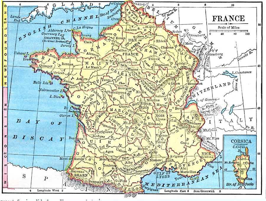
Description: A map of France in 1872, showing major cities and towns, rivers, and terrain, and an inset map of the island of Corsica. This map also has, on the left margin, a latitude reference to Newfoundland and Wisconsin.
Place Names: France, Nice, �Paris, �Nancy, �Bordeaux, �Lyo
ISO Topic Categories: boundaries,
inlandWaters,
location
Keywords: France, physical, physical features, boundaries,
inlandWaters,
location, Unknown, 1872
Source: James Monteith, Comprehensive Geography (New York, New York: A. S. Barnes and Company, 1872) 65
Map Credit: Courtesy the private collection of Roy Winkelman |
|